Two engineering students from Başkent University in Ankara have successfully designed a drone that continues to fly and perform reconnaissance missions fully autonomously in environments lacking GPS signals or heavily affected by jamming devices.
In the modern world of aviation, dependency on Global Positioning Systems (GPS) is considered one of the greatest weaknesses of drones on battlefields and in crisis zones. However, on June 28, 2026, news from Ankara signaled a major step toward eliminating this dependency. Aslı Cihan and Utku Baydan, fourth-year Electrical and Electronics Engineering students at Başkent University, have successfully developed a system that enables drones to find their way without the need for satellite signals [1].
Introducing Project 'BARGU': Innovation in the Heart of Ankara This project, named 'BARGU', was brought to fruition under the supervision of prominent professors such as Dr. Deniz Karaçur and Dr. Gülşah Demirhan Aydın. The name Bargu means 'booty' or 'spoils' in ancient Turkish, and its primary goal is to create an independent navigation system for unmanned aerial vehicles in difficult operational conditions [2]. By combining advanced technologies such as image processing, artificial intelligence, sensor fusion, and embedded systems, these students have built a drone that is resistant to intentional signal interference.
Image Processing Technology; An Alternative to Satellites The most important feature of BARGU is its ability to perceive its surroundings without relying on GPS. Using mounted cameras and AI algorithms, this drone compares real-time images of the ground with maps pre-stored in its memory. Utku Baydan explains that the device can simultaneously perform mapping and determine its position with high precision [1]. This capability allows the drone to continue its mission or return safely to the starting point even if communication with the satellite is completely cut off [3].
Countering Electronic Warfare and Military Applications In border areas and battlefields, the use of jamming devices to disable drones is common. BARGU is specifically designed to counter this threat. This aircraft acts as a 'pioneer spy drone' that can identify and detect objects in enemy-controlled areas without revealing its position due to radio signal exchange [2]. Currently, the system has achieved 72% accuracy in detection and navigation, a figure that will increase with upgrades to processing power.
International Reflections and Future Outlook The achievement of these students is not limited to Turkey's borders. Due to its innovation in the field of machine vision, the BARGU project has been accepted for presentation at the 12th International Conference on Computer Vision and Machine Learning, to be held in London in August 2026 [1]. This success demonstrates the high potential of the younger generation of engineers to change the equations of the defense and civilian industries. In addition to military applications, this technology can be used in agriculture and crisis management in areas where communication infrastructure has been damaged [3].
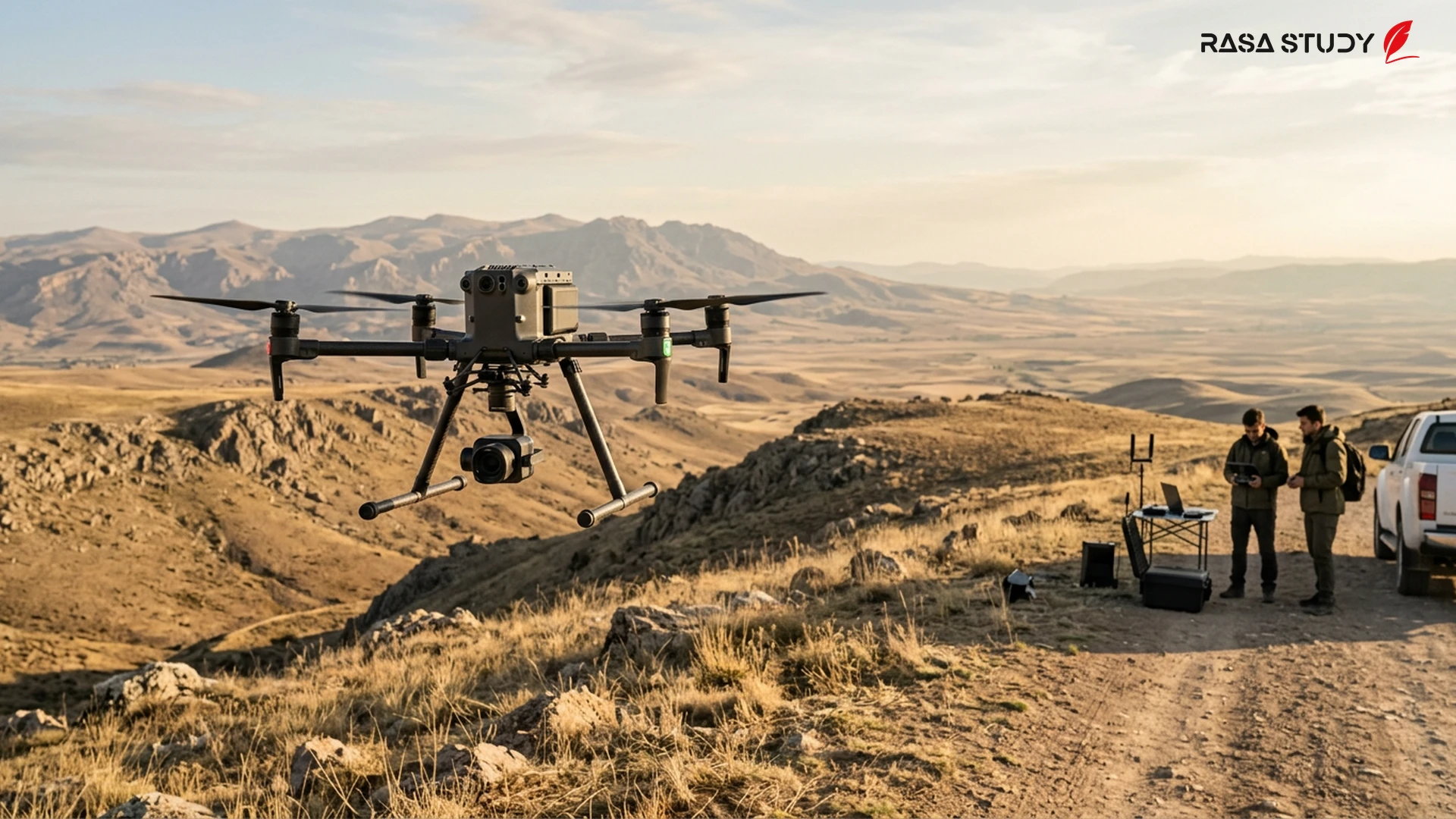
Project BARGU; a new step in the independence of drone navigation from global satellite systems.
linkSources
- Üniversite öğrencilerinden GPS sinyali olmadan çalışan İHA — DHA (2026-06-28)
- Sinyal kesicilere meydan okuyan yerli dron sistemi geliştirildi — Havadis (2026-06-28)
- Ankara'da Başkent Üniversitesi öğrencilerinden GPS'siz İHA başarısı — Haberton (2026-06-28)